File:Arangoth-provincial-road.gif
Size of this preview: 773 × 600 pixels. Other resolution: 1,400 × 1,086 pixels.
Original file (1,400 × 1,086 pixels, file size: 617 KB, MIME type: image/gif)
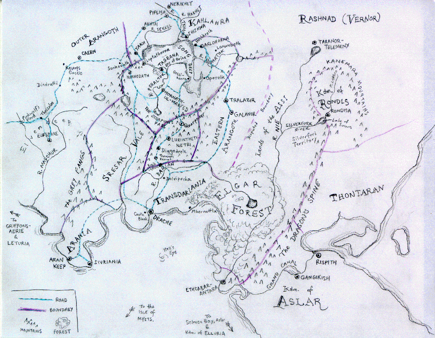
An older map of Arangoth by Pat Feaster, showing the provincial boundaries and the major roads, ca. 1998-1999.
File history
Click on a date/time to view the file as it appeared at that time.
| Date/Time | Thumbnail | Dimensions | User | Comment | |
|---|---|---|---|---|---|
| current | 02:08, 13 February 2013 | | 1,400 × 1,086 (617 KB) | Nymphetamine (talk | contribs) | An older map of Arangoth, showing the provincial boundaries and the major roads. |
You cannot overwrite this file.
File usage
The following page uses this file: